Where Qum sits in Iran, the surrounding terrain, and what to expect from its dry desert climate through the year.
Iran, the 18th largest country in the world, is located in south-western Asia and shares borders with seven other countries: Azerbaijan, Armenia and Turkey in the north-west, Iraq in the west, Turkmenistan in the north-east, Afghanistan in the east and Pakistan in the south-east. To the south of the country lies the Persian Gulf, which separates it from its Arab neighbours including Saudi Arabia, the UAE and Qatar.
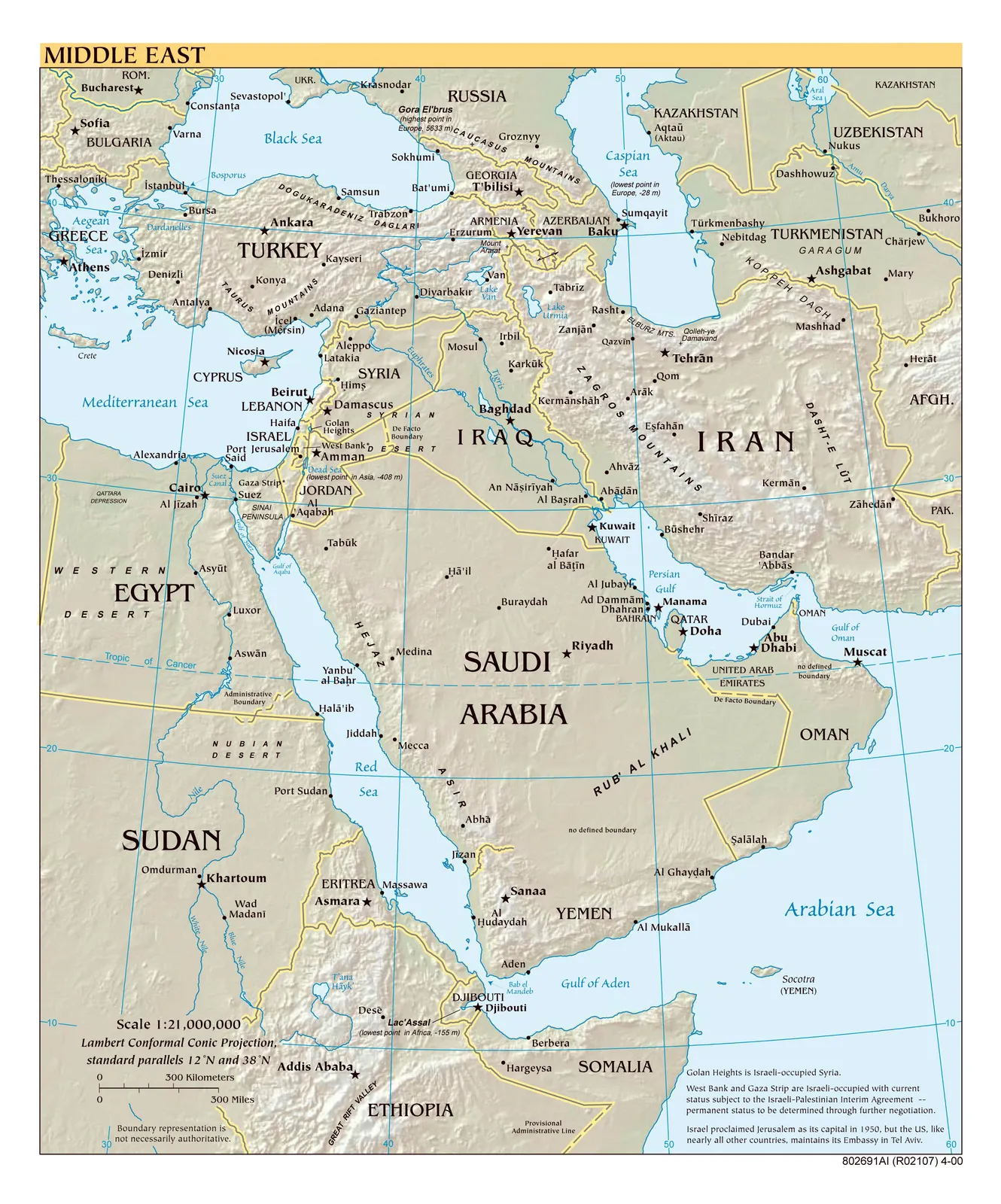
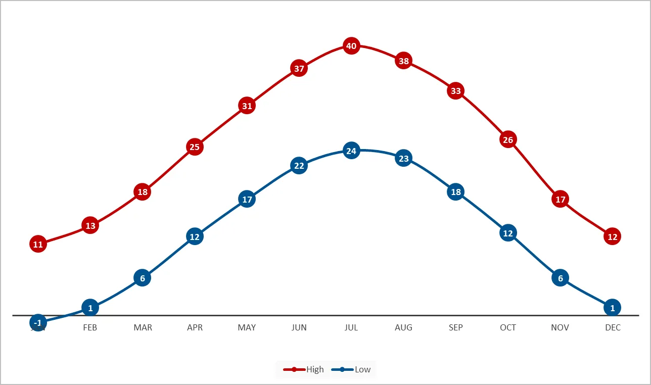
Located 140 km south of the capital, Tehran, is the holy city of Qum (commonly also spelled Qom), the seventh largest city in Iran and the capital of Qum province, with an area of 11,000 km². Qum lies in a dry, arid region and comprises mountainous areas, foothills and plains. Due to its location, Qum experiences a dry, desert climate with low humidity and little rainfall. The summers can reach very high temperatures (40–45°C) and the winter temperature can fall below 0°C. Detailed month-by-month climate and weather information can be found here.
Comments & suggestions
Have a tip about Qum's weather or getting around the region? Share it below — approved notes appear on this page.
Comments are not configured yet. Set
PUBLIC_CUSDIS_APP_IDto enable moderated comments and suggestions on this page.